Cookies op Kieskeurig.nl en de overige Reshift websites
Wij maken gebruik van cookies, en dit doen we:
Voor functionele en analytische doeleinden.
Om relevante advertenties te tonen.
Om te zorgen dat je kunt inloggen met je account.
Om onze dienstverlening te verbeteren voor onze gebruikers.
Om te zorgen dat Kieskeurig.nl gratis is en blijft.
Wil je meer weten over het gebruik van cookies en hoe wij hier mee omgaan. Lees dan onze complete privacy statement hier.
Waarom moet je eigenlijk akkoord gaan met cookies?
Cookies zorgen ervoor dat wij bepaalde functionaliteiten kunnen aanbieden aan onze gebruikers en onze klanten. Kieskeurig.nl is altijd al een gratis dienst voor en door gebruikers geweest. Om te zorgen dat we Kieskeurig.nl gratis kunnen houden tonen wij bijvoorbeeld advertenties. Cookies zorgen ervoor dat jij als gebruiker advertenties krijgt te zien die relevanter voor je zijn. Daarnaast zorgen cookies ook voor inzichten in hoe onze site presteert. Hierdoor kunnen we onze site blijven verbeteren.
Wil je meer weten over het gebruik van cookies en hoe wij hier mee omgaan. Lees dan onze complete privacy statement hier.
Hieronder vind je de meest recente nieuwprijzen bij onze directe partners, zodat je zeker weet dat je altijd een gloednieuw product met de beste garantie in huis haalt.
1-3 dagen
Check de website voor de levertijd|Gratis bezorgd > €20,-
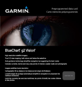
See your vessel’s precise, on-chart position in relation to navaids, coastal features and restricted areas with premium features found in this detailed marine mapping data. Includes all of the features of our BlueChart® g2 product, plus 3-D perspective above and below the waterline, Auto Guidance, high-resolution imagery, and aerial photos of ports, harbors, marinas and landmarks.\n\n- Shaded depth contours, coastlines, spot soundings, navaids, port plans, wrecks, obstructions, intertidal zones, restricted areas and IALA symbols.\n- Seamless transitions between zoom levels and more continuity across chart boundaries.\n- High resolution satellite imagery for a realistic view of the land and water.\n- Aerial photos of ports, harbors, marinas, waterways, navigational landmarks and other POIs.\n- Auto Guidance technology searches chart data to suggest the best passage to a destination.\n- MarinerEye view 3-D perspective for a quick, easy position fix.\n- FishEye view 3-D perspective for an underwater view of the sea floor.\n- Safety Shading* enables contour shading for all depth contours shallower than your defined safe depths.\n- Fishing Charts* to scope out bottom contours and depth soundings with less visual clutter on the display.\n- Plan and organize routes from your computer with HomePort™.\n\nCoverage\nDetailed coverage of the entire Spanish and French Mediterranean coast from the Straight of Gibraltar to La Spezia, IT. Includes coverage of Corse, the northern part of Sardegna, and the Islas Baleares. Also covers the northern coasts of Morocco and Algeria from Larache, MA, to Bejaia, DZ.
Laatst bekeken
Login of registreer
Waarom betalen?
Wij verdienen ons geld met prijsvergelijkingen en advertenties (zie: https://www.kieskeurig.nl/verdienmodel). Wij kunnen onze diensten aanbieden zonder advertenties en bijbehorende cookies als je een betaald abonnement afsluit. Dat kost €99 per jaar, en heeft als voordeel dat wij je geen enkele advertentie laten zien en dat wij geen tracking cookies in jouw browser plaatsen.
Wil je toch gebruik maken van onze diensten zonder een abonnement?
Heb je al een account? Log dan hieronder in en start de betaling via de betaalknop in je account overzichtspagina. Klik hieronder om in te loggen.